Thursday, November 10, 2011

Casssserrrollle


AssalamuAlaikum everybody, So....I just cooked something *peepo. So not to beat about the bush, which wouldn't be too useful as a roundabout thing to do because half the bush is in my casserole, I cooked a casserole alhamdulillah. Ummi told me how to do it today morning. And do you know that it tastes like Ummi's cooking, and I thought to myself, ...  Ummi's not here, but Ummi's knowledge is, so it proves that knowledge is partly what makes a person.  

It was a lot alhamdulillah. The meat was Udh-hiyah meat given to me seperately by two Libyan brothers may Allah bless them. They each said it was a present. 


Friday, October 14, 2011

Tryfan hike

So this is the story of our scramble up Tryfan ( Tri- as in trick, and fan- as in thon in python), which is South-West of Bangor, and near a town called Bethesda. We arrived by the A5 I think, the coach parked next to a big lake on our left, and Tryfan towered up on our right.Tryfan is 915 m high according to the map, and I think our group climbed the North face (that sounds very mountaineering, doesn't it!).

the route we took was straight up then following the ridge in the center of the pic to the right.

the stone path we followed in the beginning. There isn't much protection on the right.

the mountain that was across the road and lake. 

part of the trail. I can't remember if we came up the right or the left one.


scary looking pic!


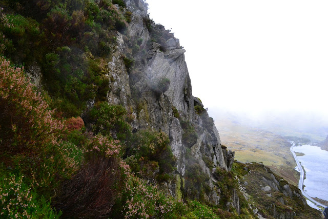
this is a spectacular view mashAllah. ( also a bit dizzying for lowland creatures like myself )

pretty plants!! subhanAllah

so the trail goes right up this slope. Just straight up it then round the corner. there's no escalator.


I think all these strewn boulders are from rockfall. What do you think? Wikipedia rockfall to know what rockfall is.

coming up to the cloud base. it's scarier, windier and wetter in there, and you know it as you're coming up


a zoom in of the opposite mountain


so we had a rest on this relatively large ridge. My foot demonstrates my immense bravery


our guide. he's helping some of the group on a hard and exposed section.


the way is always up!!

the mountain seemingly never ends. that's not the peak by the way.

our crazy guide sat right on the edge of that rock in empty space. for no rational reason. I went up there ( I'm proud of that alhamdulillah!) but only went halfway to the indent. 
the view down the mountain, from the space-platform rock in above photo. it was sooo windy on there. and scary. we shuffled up and down. in turns of course. 

basically that is scrambling. you must use your hands


then we came to this large slab sloping off into the wind. we had been climbing the other side of the mountain to avoid the wind, but as we got higher we had to go on this face. we rested here as well. 


we did come up this scary bit.

most of the scrambling higher up is like this. no protection behind you whatsoever. very scary as the rocks are also slippery and you don't always get good footholds.

alhamdulillah! the summit! it's sheer relief for me mainly because I know the way down is a different, easier trail. and you're always going down, and down feels like safety to me

another summit shot. that's just a big standing rock on my right

wet camera but sheer relief alhamdulillah. and very nice but wet local habitat

some of our 15 person group

Tryfan is up and to the left. on the right is like a twin mountain.


we waited in this basic hut for about an hour for the coach. this is right at the end of the trail next to a road

a quite symmetrical mountain across the road from the hut

Tryfan from wikipedia. 

guess what? Tryfan from wikipedia.


and have a nice time inshAllah all of you and salam.


Sunday, September 25, 2011

Snowdon hike


Sorry if some of the photos are repetitious, just say subhanAllah. When I was looking at the rainbow I thought : then what beauty is there in Jannah ? The more you look at the rainbow the more beautiful it is.

The rest of the photos are from the hike to the top of Snowdon and back down again ( no way! ). I took these photos on the descent, just as the view opened up before us under the clouds. Some photos show the trail we followed down.

It was very windy, especially near the top, and you could literally see frail standing walls of water vapour blowing around in the mist ( or cloud ). I was also extremely cold and soaked throughout my legs, and water was squelching in my boots. Altogether it was five and a half hours walking, including the half-hour rest at the cafe at the top.

The last two photos are of Snowdon itself, taken from the coach on the way back to campus.


P.S Snowdon is the highest mountain in Wales at 1085m above sea level.